 SENRA
SENRA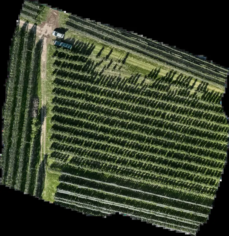
Beyond the visible.
Multispectral drone monitoring for apple orchards and vineyards in South Tyrol.
A real survey
The same orchard read with different indices: each shows what the photo does not.
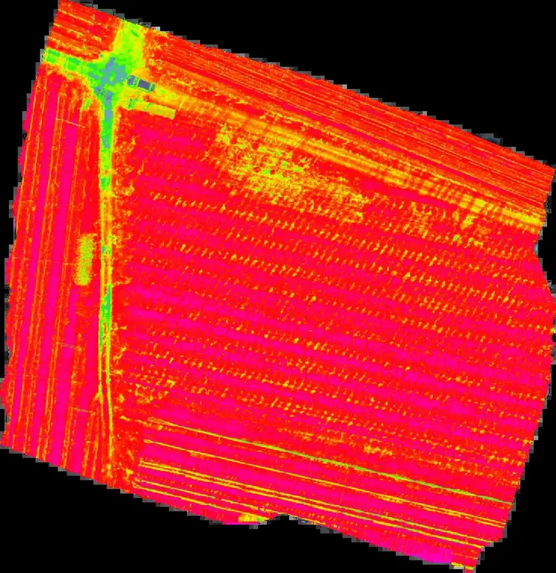
NDVI
Shows overall vegetation vigour and where it changes from one zone to another.
Demonstration survey of 4 October 2026 with a DJI Mavic 3M. GPS positioning without RTK correction: error of about 0.2 m.
Download the sample report (PDF)How we work
The map shows where areas differ, not why: the why is verified in the field.
Services
One flight, vitality map and short report.
Three flights per season: bud break, flowering, fruit set.
All growth stages, annual report and on-site meeting.
Every proposal is assessed case by case.
Frequently asked questions
What is multispectral monitoring?
A drone with sensors that record, besides visible light, the red edge and near-infrared bands. From these bands we compute indices such as NDVI, NDRE and OSAVI, which show plant vigour in a way the naked eye cannot see.
What can I learn from the maps?
Where areas of a parcel differ in vigour and chlorophyll content. The map does not say why: the cause is checked in the field.
Which crops do you work on?
Apple orchards and vineyards in South Tyrol. For other crops, write to us: we assess each case individually.
How accurate is the survey?
In the demonstration survey: 0.59 cm per pixel on the ground at a flight height of 21 m. GPS positioning is without RTK correction, with an error of about 0.2 m.
When do you fly?
The SEASON service includes three flights: bud break, flowering and fruit set. The YEAR service covers all growth stages, with an annual report and an on-site meeting.
How do I request a proposal?
Fill in the form below with the town, crop and approximate area of your parcels. Every proposal is assessed case by case and we reply directly.
Let's talk
Tell us your parcels: we reply with a proposal.